Volumes have been written about Route 66; one of my first articles at CC was about The Mother Road. That time I focused on cars seen along a short section; this time, let’s focus on the various services and roadway features seen by those who used a similarly short snippet of the road back in the day and how these scenes have changed over time.
This guided tour came about as part of a convention I recently attended. Our tour route can be seen here. For this article, I’m sticking to the area between Devil’s Elbow and Rolla as that was the primary focus of the tour.
The alignment of I-44 is generally close to that of old US 66 – which is often found as a service or outer road to the interstate for a goodly portion of Missouri. The real sights to see are where the alignments aren’t so close. It’s amazing what can be seen just a mile from the interstate.
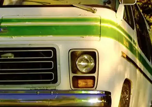
So let’s get aboard our tour bus and go sight-seeing. With the number of international tourists who enjoy Route 66, it only seems appropriate the tour bus was built upon an International chassis.
Let’s start in the east and work our way west for our virtual mini-tour.
There are several suspicions and legends on how Rolla was named upon its being officially founded in 1858.
My favorite version involves the man from North Carolina. A native of Raleigh, he supposedly had a speech impediment and wanted to recreate the name of his town. His supposed pronunciation of Rol-uh (with a short o) is what has remained. A variation of this story involves a group of Raleigh, North Carolina natives.
A different legend, favored by the Phelps County Historical Society, involves a competition with the neighboring town of Dillon. In a bid to be the county seat, the agreement was the losing town got to choose the town name of the winning location. Dillon lost and it was decided to name the new county seat Rolla after a local, and notoriously lazy, hunting dog.
Whatever the true story, Rolla now has a population of right at 20,000, is home to the preeminent engineering school in the United States, and is the headquarters for the Mark Twain National Forest.
Just outside of Rolla is the Mule Trading Post. Despite my living in Rolla for three years while going to college, I have never been to The Mule.
Once upon a time, the arm of this metal gentleman waved to traffic, but age has stiffened his joints. This picture from 2015 shows what can be found here today. That includes the two Corvairs for the eagle-eyed reader. If my memory serves, those two have been sitting here since at least 1992 when I moved to Rolla.
The by-pass around Rolla, which ultimately became I-44, began in 1953. This picture is in the vicinity of the current I-44/US 63 interchange.
Rolla is a town in which I am quite familiar and fond. Many of the landmarks of the Route 66 era are now either gone or very well camouflaged. I cannot determine where this Nash dealer was located.
This is facing north toward the I-44/US 63 interchange. These buildings are mostly all gone, as it currently looks like this:
It appears the building on the left is the only remainder; it is now a Chinese restaurant. Even some of the replacement buildings that were here in 1995 have since been torn down.
The sad Homogenization & Chain Restauranting of America has poisoned this location as a Buffalo Wild Wings restaurant sits immediately to the left of where I was standing to take this picture. How sad.
However, the upshot is this intersection hasn’t changed very much. Maybe. It is what had been the junction of US 63, US 66, and MO 72; it is now US 63 and Kingshighway, a city street.
The Kroger grocery store still exists at this location albeit in a different building. The tall building at the left edge of the previous picture is still there, housing the garage for the Ford dealer. It can be seen here directly to the left of the CVS Pharmacy.
Among my soon-to-be-disclosed stash of pictures are these car-rich snapshots of this same intersection; let’s take a look at a few:
Not very many two doors and convertibles, are there?
Here’s how it looks now:
Traffic was too heavy for standing in the exact same spot, but hopefully you get the idea. All the two-doors are now pickups.
This hotel, located on what is now Pine Street in downtown Rolla, is a prime example of landmarks along Old 66 being repurposed.
The sign truss is the magic indicator of the hotel being repurposed into the Phelps County Bank. Sadly, a few of the old buildings have been razed.
Let’s continue our journey; I could spend way too long boring you with a town that has produced a disproportionate number of politicians, including a governor who was elected to the U.S. Senate about ten days after his death.

The next town is Doolittle. Founded in 1944, Doolittle was named after Lt. General Jimmy Doolittle who lead the bombing raid on Tokyo in April 1942.
Nearby is John’s Modern Cabins. Located adjacent to both the old alignment of US 66 and an abandoned section of I-44, John’s has seen better days.
Like so many of the Route 66 landmarks still in existence along this section, the owner has no apparent interest in preserving anything. And while it is obvious these cabins are pretty much beyond repair (this is the best of the lot), the owner also shows no desire to sell to parties who are interested in preservation.
Sadly, the privy is the most structurally sound building on the place.
Our next stop is Arlington, the home of Stonydell.
Stonydell was known for its spring-fed swimming pool. In the days prior to the advent of automotive air-conditioning, a dip in the water was always a welcome way to cool off. Stonydell was quite a popular attraction.
Even their cabins were a welcome sight; drive under the arch and your bed awaited.
Driving under that arch now isn’t presenting a person with such a pleasant promise.
Mother Nature is going to have her way and she has definitely won the Battle of Stonydell.
These are the cabins seen two pictures up. It appears this arched doorway is seen on the left edge, with more of the remnants seen here.
This is the best looking building remaining at Stonydell, a building I would wager is somewhat newer than the others.
Crossing over into Pulaski County, which heavily advertises its having 33 undisturbed miles of Old 66, the next town to be encountered is Hooker. While named for a local man, the origin of the name Hooker is a good story. And, yes, it’s about what you are likely thinking.
Major General Joseph Hooker was a Union general during the Unites States Civil War (1861-1865), perhaps best known for his loss to Confederate General Robert E. Lee at Chancellorsville, Virginia.
While the true origins about the use of the word hooker are debated, one version is the band of prostitutes that followed Major Hooker’s army was referred to as “Hooker’s Brigade” or “General Hooker’s Army”. Of course, this was shortened to “hooker”, a euphemism for that oldest of professions.
However, Hooker, Missouri, wasn’t known for being a hot-bed of prostitution. This particular Hooker was named for a man who was named for General Hooker. Instead of such activities, the town of Hooker was best known for this rock cut, often referred to as “Hooker’s Cut”.
Hooker’s Cut was constructed around 1942. At the time it was built, this was the deepest rock cut in the United States. Now, whether that is the entirety of rock cuts or for roadways, I am not certain.
Also of note, this project was built by a fledgling contractor from St. Louis named Fred Weber. Successful in this project, Weber would go on to be the road contracting king of the St. Louis area; the Fred Weber company owns an abundance of quarries, asphalt plants, and other related enterprises in the St. Louis area. A Fred Weber asphalt plant was one of the first in the nation to use methane (sourced from a Fred Weber landfill) to heat product.
This segment, unlike many others of Old 66, is still maintained by the State of Missouri, marked as Route Z.
As an aside, Missouri and Wisconsin are the only two states in the country that use letters to denote routes. The only real difference is Missouri does not use the letters G, I, L, Q, R, S, or X – however, there are a few route RA’s and one Route AX that accesses the town of Axtell.
There have been several conversations over time here at CC about the advent and growth of automotive safety; that is only one component of the drastic decrease in the rate of traffic crash fatalities over the past decades. Roadway design has played an equal yet often overlooked role in this reduction.
As this picture from my personal stash indicates, crash testing for the safety of roadway appurtenances is a much older endeavor than is crash testing for automobile safety.
While not fully seen here, several components of Route Z are living proof of how roadways used to be constructed. The creek gravel in the concrete is but one element.
This has been a long trip, but we aren’t quite done yet. Let’s stop at the Devil’s Elbow Inn for a bite to eat.
Oh, for those so inclined, it used to be called the Munger-Moss Sandwich Shop.
Just watch your head when you enter. No, the doorway isn’t low, but all the brassieres have certainly lowered the height of the ceiling.
The current owner of the Inn chatted with our group about how he came about owning the restaurant and the multitude of people he has met in their travels of Route 66. This is just one page of his guest registry.
Thumbing through the registry, I found multiple persons from every inhabited continent who have visited the Devil’s Elbow Inn. The smoked chicken wings were quite good, so I’m sure the food is part of the appeal. The free liquor for women who add their bra to the collection is undoubtedly enticing.
Devil’s Elbow is named after a bend in the Big Piney River that created frequent log jams in the early timber cutting days.
Google Maps is able to provide a better idea of the curve than what I can describe.
However, there is some understandable confusion regarding the origin of the name. The bridge over the Big Piney River, adjacent to the Devil’s Elbow Inn, has a nasty curve in it that has caused problems since Day One; this curved bridge has erroneously been considered as being the Devil’s Elbow. Sometimes you have to curve roads and bridges when trying to work around a bluff.
This bridge has carried an unknown number of persons over the years. Restored a few years ago, it has carried soldiers to nearby Ft. Leonard Wood and has ferried all manner of people during its life.
During World War II, a wrecker was stationed here to maneuver the end of tractor trailers so they could cross the bridge without hitting the rails. That has undoubtedly fueled the confusion on what constitutes the elbow.
This old bridge has seen a lot over time.
Another area of potential confusion is just above the Devil’s Elbow Bridge leading into the town of Devil’s Elbow; there is a section of roadway that was notched out of the hillside and it has a nasty history of people running off into the valley. This stone wall, a far cry from what would be used currently to stop errant vehicles, was installed to keep cars on the roadway.
The wall has been here since at least 1924.
This is looking to the bottom of the valley. Any car that ran off the road would fall for about a mighty long time before landing. The bridge seen here is for a railway line servicing Ft. Leonard Wood.
The Devil’s Elbow bridge was bypassed with a new, wider, and uncurved bridge around 1942 – which makes sense given the construction of Hooker’s Cut just a mile or so east of there.
For the bridge aficionados who are reading this, this bridge is still in active service and is part of Route Z, mentioned above. These old arch bridges are quite stout; a conversation I overheard was of someone once charged to demolish an arched bridge of this era. He said these bridges were so strong the first round of explosives did absolutely nothing to the structure.
You might also notice the sand on the ground and the balls of leaves in the tree branches. There was a record breaking flood on the Big Piney the last week of December and the water was indeed this high.
I was standing on the ground looking up to take these pictures; these leaf balls are at least 10′ above the ground. Breaking previous crests, the December 2015 flood had nearby I-44 closed for several days as it had over 4′ of water above the centerline.
Like all things in life, this tour must conclude.
For those interested in the history of Old US 66, or who simply enjoy looking at vintage pictures, I found all the old pictures featured here at www.66postcards.com. The pictures featured here don’t even begin to scratch the surface of the thousands of pictures to be found from Missouri alone.
There are pictures to be found from every state that contains Old 66 and there is no shortage of car pictures (and surprises) such as this wrecked Ford.
Author’s Note: A special thanks to Roamin’ Rich and Route 66 author Joe Sonderman for being such a terrific tour guides.










Great tour!! When my sons and I did 66 in IL-MO-KS-OK a few years ago, the best sights were in MO. John’s Modern Cabins is deceptively difficult to find, being off that abandoned alignment of I-44. But it’s worth it. And thanks for sharing the pics of the restored bridge at Devil’s Elbow!
“… crash testing for the safety of roadway appurtenances is a much older endeavor than is crash testing for automobile safety.”
Any date for that pic? I’d guess that the car they were crashing was already old since the road barrier, not the car, was being tested.
Hotels seem to be the worst for genericization, FWIU most of them are developer-owned and only contract with a chain operator for a set number of years so even chainwide distinguishing features like Howard Johnson’s midcentury orange roofs are out because it might be a Ramada or Holiday Inn when they go into the next contract period.
1930s era. I suspect it was localized testing, unlike how it is currently.
Great stuff Jason! Route 66 is well known over here, even if most people (me included) don’t know much about it. The observation that there is much to see and find out about just away from the main highway/.motorway.
I guess the best UK equivalents would be the A1 from London to Edinburgh which passes through almost nowhere now but used to pass through many many places. If you have the time, always follow the old road.
Another measure of our lack of knowledge about America is that I did not realise towns were still being founded in 1944
I suspect founding of towns was slowing down considerably by 1944 and many were starting to dry up. The only thing currently notable in Doolittle is the “Made From Scratch” restaurant where eating a 5 lb hamburger in one hour or less means it’s free.
For context, in 1944 Hawaii and Alaska were still 15 years away from statehood.
Very cool Jason. A family friend did the whole thing in his 56 Chevy last year and showed me his photos. He did his research beforehand and had a great time. Two other couples went along, I think with a 63 Stude wagon and a 69 Chevelle.
He too mentioned the lack of Americans on the road in October. Lots of German guys on motorcycles, and Canadians in old cars.
It’s on my bucket list to do as well, not sure if I want to use two or four wheels though. Hmm could be a good QOTD, what’s your preferred vehicle for a Route 66 trip?
Thanks for the tour. Back in the 70’s I went through parts of Rt.66 in New Mexico and Arizona but it wasn’t a big deal then. I hadn’t read much up on it. Last year I went from Flagstaff Az. into Ca. through Seligman, which was the highlight. I’ve got the maps and books and would like to do the whole route someday.
Great tour — I especially like the then-and-now photos.
I couldn’t resist a challenge, so I tried to determine where the Nash dealer was located. The website nashparts.com has a list of many former Nash dealers, and there’s a dealer in Rolla listed as having been located at 702 N. Bishop Ave.
Looking at the Google Street View (https://goo.gl/maps/bXt9pPQoKYu), it looks like the road and topography match. The field to the left looks like the college’s stadium grounds, and the tudor-style building in the distance looks like it’s now a fraternity. As for the Nash building itself, it looks like it’s no longer there — just a part of the Ford dealer’s lot. Just a guess, but that may just be the site.
The survival rate for Nash dealerships is probably pretty low. Of the three near me in Virginia, two have long since been demolished; the third still stands and is the used-car showroom for a Hyundai dealer.
That likely is the site given what you describe and the terrain shown in my picture above. How weird; I drove right by there this morning.
There’s a former Nash dealership still standing in downtown Durham, North Carolina. Today it houses a number of small businesses, including a well-regarded farm-to-table restaurant and a bakery. Hard to tell what it once was if you didn’t already know–just a long, low, white brick building with large glass openings, most of which are now doorways to the individual inner spaces.
I love these posts! It lets those of us who have little time to get away (okay, little money) get to know the USA with a CC perspective. Thanks Jason!
Good stuff, thanks for sharing.
“Old road” trips can be a lot of fun when the point is the road and not getting there.
I like Hampton Inns, but loved staying here on a “road” trip through Pennsylvania on the Lincoln Highway. My own little house for the night.
My “neighbor” had a much more interesting car than my Nissan. We were both making our way to the AACA fall meet in Hershey.
I had one of those little yellow and white Metropolitans way back in early 60s. Loved it but you had to access the trunk thru the back seat which folded down!
That was awesome Jason, Thanks! Made my day
Well, Jason, you forgot to mention the Diamonds restaurant – both the original and the newer versions, both defunct, I think.
We ate at the Diamonds a few times so very long ago, 45-55 years at least!
Also, sections of Route 66 and I guess many other U.S. routes had curved curbing along the edges for safety reasons, sort of like curbing used in subdivisions now – if a driver began to swerve and in danger of running off the road, the curbing was thought to guide the car back to the road. Unfortunately, the opposite was true – the cars usually flipped over or caused head-on collisions!
One other unusual feature was the addition in places of a center passing lane – a suicide lane. Those three-lane sections were notorious, and many times along U.S. 40 in Chesterfield, dad wound up playing chicken with an oncoming car, both trying to pass their respective slow-pokes on a Sunday afternoon drive out to Lobmaster Field to show me the planes, which was across the road from where Spirit of St. Louis airport is now!
Being from the STL area, we and I traveled route 66 many times, both in Missouri and Illinois.
the devils elbow inn and the bridge made me think of the opening scene of one of my favourite movies..”My Cousin Vinnie”