I’m of the firm belief that driving across the country should be on everyone’s bucket list. Not necessarily the way I did it for the first time – traveling solo on a fairly compressed time schedule and knowing that you need to quickly find a new place to live at your journey’s end – but that’s exactly what I did in the late summer of ’71, driving alone from Morristown, New Jersey to an unknown final destination in southern California, where I would officially enroll at the Art Center College of Design in Los Angeles in only a few short weeks.
I’ve previously written about the heady mix of freedom and personal mobility that comes with one’s first driver’s license, but even that pales compared to the almost-intoxicating feeling of loading up the car, taking the wheel, and taking off in a general westerly direction. Sure, I had consulted a Rand McNally Road Atlas beforehand, and took a well-thumbed copy with me, along with picking up a series of multi-state road maps along the way, but those converging and diverging red and blue lines convey little of the wonder and excitement that’s part of knowing and yet, not exactly knowing what’s around the next bend.

I got an early start from home on my first day on the road. I was so exhilarated by the simple joy of beginning this asphalt adventure that at day’s end, I found that I had clocked 845 miles, much of it trying to block the afternoon sun through my bug-splattered windshield. Stopping only for fuel and a brief mid-day roadside fast-food snack, that night’s stopping point was a TraveLodge motel just over the Indiana border in Marshall, Illinois.

No idea why I selected that hospitality brand as my road-trip go-to; perhaps the friendly, comforting image of their smiling sleepy bear logo had some sort of subliminal effect. At any rate, by that evening I was glad to grab a light dinner, briefly consulting the atlas to peruse the next day’s route before retiring…
The second day of my westward excursion found me continuing southwesterly on I-44 through Illinois, just missing the southeast corner of Kansas and crossing into Oklahoma. Repeated sightings of numerous pumpjacks in the distance, as well as the odd herd of cattle visible from the Interstate, reminded me that I had surely left the East Coast far behind. Ending the day’s journey in Oklahoma City, I found that I had covered another 652 miles. Realizing that my sub-1,500-mile total so far was only about halfway to my final destination, I began to appreciate the continent’s vastness, briefly wondering whether I would in fact reach Los Angeles, or whether that city was merely a far-off mirage conjured by the entertainment industry (I’ll leave that for others to ponder).

Day Three brought a constantly-changing view out the windshield. The day’s light seemed to take on an ethereal quality, emphasized by the newly beige and brown landscape as I made my way further westward. Additionally, the ever-present Spanish-influenced southwest architecture, whether real or contrived, was more proof that I had truly traveled far from my accustomed surroundings. Yes, the U.S. West was different, I was beginning to realize, as I rolled onward, counting the I-40 West signs along the way. At this evening’s TraveLodge, I counted another 679 miles completed. Now, with nearly 2,200 miles completed, my eventual destination seemed within reach…

As I left Gallup, even though I knew instinctively that I was nearing the end point of my cross-country odyssey, the days on the road driving solo had begun to take a toll. Sharing the Comet’s interior with those worldly possessions of mine that wouldn’t fit in the trunk, I had even begun to feel a bit claustrophobic. Lowering the top now and then might have helped, except that I worried about the highway-speed security of my cargo under those conditions.
The Comet was performing faultlessly, stopping only for gasoline, mid-day roadside fast food, and the occasional rest stop. The temperature gauge never budged, and the 289’s oil consumption was zero. Reliability, always a good thing, would be even more important during the next, shorter legs of the trip west. Now I was pointed west/southwest from New Mexico, heading for the hamlet of Blythe, California.

Though it was mid-September, I was unprepared for the late-summer dry heat of the southwest. Pivoting the vent windows and opening the driver’s-side under-dash vent did little except forcing more warm (ram) air into the passenger compartment, but at least the air was moving. Evenings brought an unexpected but appreciated drop in temperature, making the end of each day’s drive more pleasant.
After a somewhat later morning start, the fifth day on the road took me from Blythe, California to Needles. This stretch turned out to be one of the most desolate, least-populated segments of the entire trip. There were few structures of any kind visible from the then two-lane state highway. Noel Coward famously sang that only “mad dogs and Englishmen go out in the midday sun,” and neither were in evidence on this leg of the journey. In fact, the road was essentially empty, except for a couple of vehicles passing in the other direction. Small elevation changes and the occasional sweeping curve provided the only respite from highway hypnosis. As there were no roadside services of any kind, I was glad to have had the presence of mind to buy some snacks and a full tank in Blythe.
The day’s driving totaled less than 100 miles, but they were the most enervating of the entire trip so far. I retired for the night hoping that the following day would end at my as-yet unsecured new living quarters in Los Angeles.

From Needles, I continued west on I-40, then heading mostly southward along I-15, where the traffic volume began to build. As I got closer to the I-10 West, the traffic volume built steadily, and after merging onto the I-10, my average speed decreased dramatically, and I began to understand the incredibly car-intensive nature of SoCal personal travel. Briefly, I considered whether my hoped-for future as an automotive designer might unfortunately help to perpetuate this state of affairs. I quickly banished such thoughts from my mind though, as I needed to stay alert for the first lane-splitting motorcyclists, a phenomenon I’d never encountered back home.
Alert readers will see that the Google map posted above shows the city of Thousand Oaks as its terminus. That’s because I ended up there, driving west and keeping my eyes peeled for the “Los Angeles” exit off the I-10, which had by then merged into the 101. Exiting the Interstate for a fuel stop, I eventually figured out that I had overshot my destination, which was now to my east.

While it’s true that the Comet had proven itself a mostly worthy coast-to-coast companion during most of the trip, all had not gone completely smoothly, as I related in a September 18th letter home: “I registered in the Downtown Los Angeles TraveLodge and intended to make a trip to the college that afternoon, as well as to look for a place to live. But the car developed water pump trouble…a new water pump, antifreeze, and new drive belt was installed at a gas station down the street from the motel, for $50.64.”
To make an even longer story short, I soon found acceptable boarding-house accommodations not too far from the Art Center campus at 5353 West Third Street (the college did not then, and does not now, have its own student housing) and settled in to start my higher-education career…





Rand McNally’s and driving long distances within the United States is something my wife and I have done A LOT OF over numerous international trips to the USA. Here’s a summary of our adventures to the USA.
1/ My first visit to the USA was in November, 1982. As of 2024, I have made in excess of 23 trips to the USA. Living in Australia this meant 46 Qantas 15 hr flights across the Pacific Ocean. The most recent was in July, 2023.
2/ My wife and I have driven in excess of 45,000 miles around the USA visiting almost every mainland state. We did this mostly in rental cars but also in a ‘83 Cadillac Eldorado and a ‘65 Corvair Monza convertible. We shipped both of these cars back Australia then fully ground restored them and converted both to right hand drive.
3/ Our considerable travel in the USA was completed without GPS technology. The only navigation assistance we had was our copy of the Rand McNally. We still have these Rand McNallys today with all our travels highlighted.
4/ There is little, very little of the USA that we have not seen in detail. In fact we have seen more of the USA than of our own country Australia. We figure that we can see Australia when we to old for long distance 15 hr flights.
Yes, Rand McNally’s have featured heavily in our extensive US travel.
Your exploration of the US is quite impressive. I read a while back the average American will only visit 12 states in their lifetime, which is really rather sad, so you’ve got a leg up on much of the population here.
I’ve only lived in one state my entire life, but I’ve driven my own vehicle in 36 states plus DC, as well as 2 Canadian provinces and 2 Canadian territories, plus one Mexican state. Of the handful of North American built cars I’ve owned, only my Tijuana-built Tacoma has visited the state where it was manufactured; our St Louis-built Ford has been all over but never in Missouri. And while my Vega did get pretty far from home, it never crossed the Rockies let alone got out to Lordstown. If I add rental (or borrowed) cars for business or personal travel, I think it only adds about 3 more states plus about half a dozen European countries.
There is little, very little of the USA that we have not seen in detail.
I assume that the definition of “in detail” is variable, as after 30 years of exploring the remote back roads and hiking trails of Oregon I’m increasingly convinced I’ll never remotely see all of it in detail.
The Garmin GPS is in the back pocket of the driver’s seat.
Yet, I still have a road atlas in the back pocket of the passenger seat with several other fold out maps from various state rest stops.
Some of us are a bit analog and won’t let go!!
I absolutely agree that driving cross-country should be on everyone’s bucket list. When I was 16, my father and I drove cross country together, and that trip remains one of my favorite memories. At the time I insisted I’d make a similar trip again, though 30+ years later, I have yet to quite drive coast-to-coast again.
And for that trip back in 1989, I planned the whole thing out on a Rand McNally atlas and AAA tour books. Also, I remember staying at several TraveLodge motels on that trip.
These days, even with Google Maps, etc., I still buy a new road atlas annually.
I still buy a new road atlas annually.
Do you wear them out that quickly or are there actual changes? I’m still using one from the aughts.
Just tradition on my part. When I was younger, I loved buying a new atlas every year – it was suggestive of new trips and adventures to come. I rarely splurge on unnecessary things these days, but I still treat myself to a new road atlas every year (two, actually, since I give one to my kids).
My DeLorme maps, on the other hand, are mostly older.
I always wanted to do the “cross country trip”. Once I passed the “early, mid “50’s”, age range I lost the desire..lol
I’d still like to ride the train though.
Analog maps are much better…no worries about cell phone reception or, if in large cities, your location isn’t bounced around as we once had in Chicago. Plus maps force you to look at things to navigate your route.
I’ve done two driving trips out west (where I did the driving) although I did start off more centrally located than you did! I still need to do a driving trip east again.
For what it’s worth, I-44 does not go through Illinois…it’s eastern terminus is St. Louis.
I’m sold on satellite navigation (with my phone though, not a dedicated unit) and have multiple mapping/nav apps on my phone with regions downloaded for offline use. But I still have a Rand McNally road atlas in our travel vehicle plus lots of now aging AAA maps. I’m particularly appreciative of states whose Transportation Departments provide free high quality maps … in the West, Nevada, Oregon and Washington are great. California has nothing 🙁Despite my love of road travel I’ve only driven cross-country (and back) once, and quite recently, in 2016 in the Toyota Tacoma which I still own.
I’m traveling today, and just stopped at a rest stop in Illinois, and just picked up a new “Official Highway Map” – with large print too, which is appreciated by those of us with aging eyes.
So add Illinois to your list of states that do this well.
Any time is good time to do a cross-country drive, but I believe that it’s all that much more special when woven into a time of life where each discovery of something new is indeed a discovery and can form a memory that can be used for years to come. Great article Stephen.
I haven’t stayed in a Travelodge for years. But as I recall, they were sort of at the bottom of the foodchain for actual chain hotels…just a step above non-chains. So for one wanting to save money and still stand a better than average chance of not getting murdered in ones sleep, they were the way to go. Or at least that was my logic back then.
I also agree entirely with those here praising analog maps. I made sure that a Rand McNally was a present to my newly minted driver on the first Christmas after his licensing. The ability to actually SEE where you are headed and where you’ve been is something that analog maps excel at and that can be hard to do with digital maps. Also, analog maps allow you to see the various possibilities for getting from point A to point B. You can do this digitally, but it’s more difficult and therefore is less likely to happen.
Digital maps are about getting to places. Analog maps are about traveling.
“at the bottom of the foodchain for actual chain hotels” – let’s not forget Motel 6, which has always served as my own version of bottom of the food chain.
“Digital maps are about getting to places. Analog maps are about traveling.” – I think you have nailed it.
I have had the pleasure of driving cross-country five times, all of these trips solo and a long, long time ago.
For those of us in the crowded Northeast, the western vistas are real eye-openers that can only be experienced by being there. For those of us who believe that reliability in automobiles is a recent phenomenon, my experience says “not”.
The first trip was in a ’61 Econoline pickup (with a bunk in the back) starting from the NYC area to Medford, OR (and back). The truck was about 6 months old at the time and suffered no problems.
Next, in a ’61 Morris Minor from the NYC area to Eugene, OR. The Minor, about 6 years old at the time, periodically suffered a balky fuel pump (cured by waiting a bit) and a burnt valve in W. Virginia (but continued on to OR anyway).
Next in a ’67 Volvo station wagon from the NYC area to Eugene, OR. The Volvo was also about 6 months old and suffered no problems.
Next in a ’66 Valiant Signet hardtop from Northern VT to Oaxaca in Mexico (and back). Despite being 17 years old at the time, the Valiant suffered no problems whatsoever.
Finally, in a ’77 Toyota Liftback from Northern VT to Oaxaca (and back). The Toyota was 14 years old. It needed fresh brake pads in Mexico, where Toyota parts were unavailable, but remedied from modified Renault pads. It also experienced disabling carburetor problems on the return trip, which I was finally able to fix myself.
So, remarkably, I never suffered a real breakdown, an accident, or even a flat tire during all of these rambles.
A testament to the virtues of curbside classics!
I love paper maps for the big picture, but my appreciation for apps like Gaia keeps growing. With maps downloaded, even without cell coverage I cannot get lost in even the most remote forest roads/desert tracks or hiking trails or off-trail mushroom hunting. It’s a revelation.
I’ve never done a single continuous cross-country road trip, but plenty of long trips, both hitchhiking and driving. But I doubt I’ll ever find myself east of the Rockies again. “The West is the best…”
I have traveled fairly extensively east of the Mississippi, but much less so in the west. I completely agree that a good road atlas is tough to beat. I kept a big one in our main car for years, but have been without for awhile.
I have never done a straight cross-country trek, but would still like to. That is one place where having a convertible isn’t much of a benefit. In my experience, highway-speed wind turbulence with the top down is tiring for the driver over a long stretch. And you may have had the most heroic little water pump ever. For it to hold on to almost the end of your trip before letting go is something worthy of a classic Disney movie.
Everyone should make a cross-country trip by car, as it’s the ultimate American experience.
Every five years or so, I have driven from Texas to the East Coast, usually a round trip of 4,000 miles or so and generally two 14-hour days back-to-back each way. While I find long distance driving to be fun for the first day, it gets old by the afternoon of the second day and delays caused by accidents, road construction and traffic congestion grow ever more frustrating. I generally prefer to fly, but long-haul trips were taken for reasons ranging from avoiding exorbitant airfares, the need to haul kids and their stuff to college and back, and, most recently, to empty out the house of an elderly parent.
In addition, I have driven in all 50 states, four Canadian provinces, four Mexican states, and several European countries. And yes, the driving is easier and more pleasurable west of the Mississippi than east. The heaviest truck traffic surrounds major logistics hubs like Chicago, Dallas, Atlanta, North Jersey and Los Angeles, and can be a real hazard to health and safety. Still, most US highways are built (if not maintained) to a high standard and there is less congestion than in other countries, so overall conditions are generally quite safe. Unfortunately, our drivers aren’t always the most attentive, patient, or skilled and my experiences in recent years indicate that conditions are getting worse.
Count me as one who appreciates paper maps and the annual Rand McNally atlas, though Waze and other GPS apps provide invaluable real-time information.
I’ve been fortunate to make those trips without any mechanical issues. The worst experience was losing a tire on a brand new car to road debris in Memphis a few miles from my hotel for that night; fortunately, a TennDOT rescue crew arrived a few minutes after I pulled over to the shoulder to change the tire for me, gratis. A Honda dealer across the street from my hotel had a new tire in stock for installation the next morning.
46 States so far. Not bad for an Aussie. I do love a USA road trip. Looking forward to our next one in 2024.
Friendly people, great roads, and plenty of planes, ships, cars and armour to keep me happy for days.
I always enjoy reading cross country USA trips. In 1978 after teaching for two years, I decided when I was young,dumb?,single, healthy,wealthy ( in travel ideas) and a little savings. I took a 2 year 50 state trip with putting in 50,000 miles on my 1964 rambler classic station wagon. Drove to 49 states and flew to Hawaii. No regrets except only to travel more ha. I joined extra miler club with ( on honor system) trying to visit all 3100’s counties in USA I joined the 50 high points which topping each of the 50 states high points. Keep on traveling 😊👍
Starting about 1990, I started getting 3 weeks vacation which (just barely) seemed to allow me time to drive with my parents back east (we live in Texas, but our family is on the east coast). My Dad retired in 1990 too, and over the years we averaged a trip every other year or so…with 3 people and enough time it seemed better than flying for us and saved us having to get a rental car.
I bought my current car in 2000; in 2005 we took a non-typical vacation to California (probably my last real vacation I hate to admit) which (other than my parents) didn’t otherwise involve family. Unfortunately, much of the travel recently has been to funerals, most of which have involved flying, but a couple were not expected and we were actually able to drive in time to attend. The first of these was for my Aunt in Massachusetts, we hung out at my (other) Uncle’s house in Pennsylvania until it seemed my Aunt’s time was drawing near, we got there in time for my Dad and him to get into a disagreement; so we left going to the coast, giving my Uncle some space. My Aunt unfortunately died while we were headed back to their home.
I’ve taken my car on other longer trips (mostly to Pennsylvania, about 3400 mile round trip), but my car only has about 147,000 miles on it…in 23 years. Most of my driving is short trips around my city, or we took another car (my Dad’s) on some of the longer trips.
Those days are behind us; We haven’t gone on such a trip since 2011, Dad’s gone now, and Mom doesn’t drive anymore (my sister assumed my Dad’s former car). Really all our long drives pre-date our ownership of real-time computer based navigation (we did get AAA Trip Tix and used an early computer based routing system setup ahead of our trip) I still own a well used (the cover is off it ) 1992 version of Rand McNally I guess I’m overdue for another one.
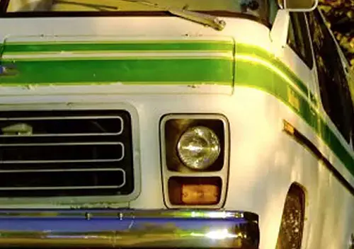
I grew up in a family where cross country trips in the car were part of our DNA. I was born in California, but my parents were from rural Alabama. They were part of the Great Migration of African Americans leaving the deep south for hopefully better opportuities out west or up north. We would make the 3 day journey mostly along Route 66 (I-40) virtually every summer so we could spend time with our grandparents, aunts and uncles, and extended family. Dad always owned a large roadworthy car for the long trips, and small “beaters” that he and mom would use to go to/from work – both parents worked in the public school system. Dad’s rides of choice, which he always bought used when they were a couple of years old, included a 52 Buick Roadmaster, 57 Buick Roadmaster 75, 61 Buick Electra 225, 65 Buick Sportwagon, 71 Lincoln Mark III, and finally a 77 GMC Motorhome. We never stopped at motels along the way except in the western states (Arizona or New Mexico) – Once you were east of New Mexico, most motels at the time (1950s – 60s) would not receive Black motorists and sometimes it was spotty even in the western states.
When I became of age, I chose to attend Howard University in Washington, DC. We drove there in the GMC motorhome for my freshmen year (after visiting grandparents in Alabama of course). Beginning with my sophomore year, I drove myself there – usually with a close friend with a similar background – we trailed each other and pulled off the road at night to sleep in our cars. For my sophomore year, I had a 72 Ford Capri that was once my mother’s car. The little Capri was just OK on the long road – it had the 2000 cc engine with an automatic transmission, but had a pretty stiff suspension. The Capri didn’t last beyond my sophomore year, so during the summer before my junior year my father found the funds to purchase for me a 74 Opel Manta Luxus – 4 speed with a manual sunroof! It was a great little car and much more comfortable than the Capri – I still own it today. I made the cross country trip to DC in the little Opel for 3 years (I took 5 years to finish), and then for 2 more years between California and Michigan for Grad School. In addition, there were many trips between DC and Alabama, DC and Michigan, Michigan and Alabama, and many other destinations. The Opel was always ready to roll and never left me stranded on the highway. At some point, I replaced the engine with once from a salvage yard, and it went through a few clutches, clutch cables, mufflers and other mostly minor repairs. Years later I gave it a total restoration and the little blue Opel cotinues to roll today!